Duco van Amstel
Life is a big Do-It-Yourself box with everything in it, except for a manual.
.
The End Game
This last post on my stay in New Zealand is more about my personal experience than about what I did. It also is kind of special as it is written in a mixture of my three languages. My apologies for those not familiar with all of them but this is a liberty I allowed myself to take. Thank you for following my travels and for the numerous supportive emails I received over the months. In the case you came to this page because you are travelling through kiwiland yourself or planning on doing so please feel free to contact me.
Slices van mijn vie
Onderweg naar Auckland heb ik de bus genomen voor de laatste etape tussen Rotorua en Auckland. C'est en partie en resonance à mon premier voyage en Nouvelle-Zélande entre Auckland et Wellington, le trajet où pour moi tout a véritablement commencé. An adventure of which I would not have predicted the tiniest of bits. Non pas un simple pas en avant dans l'inconnu mais un saut dans l'abîme. I knew that I was prepared for everything (or almost) but I certainly did not knew what part of this state of preparedness I was going to use. Nu denk ik terug en worden mijn hoofd en gevoelens overvloeid door de samenvatting van alle ervaringen van de laatste zes maanden. Vandaar de mengelmoes van talen want mijn hoofd kan sinds mijn verhuizing naar Frankrijk twaalf jaar geleden niet meer in êên taal denken. Plus j'avance dans le temps et plus ce côté multi-linguistique fait partie de qui je suis.
Some of the experiences I had here were together with other travellers or locals, others belong only to me. From the joy of talking late into the night with friends made in Hanmer Springs to the overwhelming feeling of freedom in the wilderness during my tramping. L'histoire d'une vie avec ses moments agréables, douleureux ou étonnants, ses expériences enrichissantes, ses triomphes, ses secrets. Een lijst van dingen waar ik nog lang mee door zou kunnen gaan. Het is (gedeeltelijk) waar dat reizen je veranderd, maar nu ik terug kijk denk ik meer dat je jezelf gewoon meer ontdekt en dat je tegelijkertijd je aanpast aan de situaties die je tegenkomt. Ce que je veux dire par là c'est qu'en revenant en France je retrouverais nombre de mes habitudes d'avant comme si rien n'avait changé. D'un autre côté certains détails ne seront plus jamais pareils, changés par cette nouvelle connaissance de soi. Life from this point of view is just like a spiral: always passing above the same points but never in the same position. C'est à nous de décider par nos pensées et nos actes si cette spirale est montante ou déscendante, si un haut ou un bas existent et si oui quel sens leur donner.
Ik zelf sta nu aan het eind van een gedeelte van mijn leven in Nieuw-Zeeland maar ook aan het begin van een nieuw avontuur in Frankrijk. Dit brengt uiteraard weer een groot aantal onzekerheden en aarzellingen met zich mee. Mais tout comme je l'ai appris depuis tout jeune dans les classes de ski, quand on a peur ou que l'on pense perdre le contrôle il n'y a qu'une seule chose à faire : se pencher en avant et avancer et surtout pas arrière." En dat ben ik dan ook zeker van plan te doen: het avontuur te gemoed treden met zelfverzekerdheid en niet aarzelen. Het feit blijft dat wat er ook gebeurd jij de enige bent die je problemen kan oplossen et dat geldt beide als je al aarzelend de toekomst in loopt of dat je dat met duidelijke en krachtige stappen doet. I myself prefer by far the second option.
However to do this one should remember that living in the past means looking and leaning backwards, that living the future means standing on the top of your toes with the instability of all the hypothesises and assumptions about what could happen to see as far as possible. To lean forward you have to live in the present, in touch with reality, being able to react to it and doing so when necessary to follow the path that you see in front of you using the experience you have gained before. Souvenez-vous du passé, aimez le futur, vivez le présent. S'il y a une chose que j'ai appris durant ce voyage c'est bien cela.
A swimming trip in Doubtfull Sound
Right, left, right, left
As described in my previous post my last adventure trip on the South Island was a sea-kayak trip through Doubtfull Sound. This was an organized trip with Seakayak Fiordland. The afternoon before our departure we had a short briefing at their headquarters in Te Anau: we were going to be three customers with two guides for the whole three days. The next morning we met early (at around 5:30 AM) and made our way to Manapouri where we took a boat over Lake Manapouri to the hydroelectric powerstation. There were some great views during the boat-trip and then also during the 45 minute drive over Wilmot Pass to the inland point of the sound. Without any delay we filled the kayaks with our equipment, put on our best sandfly repelant and went out on the water. A few short exercices convinced our two guides that all three of their customers knew their way around a paddle and a kayak, even better than they expected. During the first day we paddled towards the sea passing Elizabeth and Fergusson Island we enjoyed some very nice weather and close-to-none waves. We saw quite some wildlife, especially birds and took a lot of time to take our fair share of photos. Towards the middle of the afternoon we settled down at the start of Crooked Arm where an already prepared campsite awaited us. We set up our tents and the insect shelter (sandflies !) and then enjoyed a snack with good stories from everybody and a nice meal.
Rain
In the morning we woke up to the sound of buckets of rain being thrown at our heads. This however did not douse our interest in going out on the water for some sightseeing. Breakfast was quick after which we loaded the kayaks with some emergency equipment (spare tents, etc). The goal for the day was to explore Crooked Arm all the way to its extremity. As rain did not lessen we paddled straight through the gallons of water falling down on us and we discovered the true nature of Fiordland (for the information this region of New Zealand gets about 8 meters of rain every year). This was nonetheless the easiest part of the day. After our lunch at the end of Crooked Arm we still had to get back to our campment but this meant going against the current that had started to flow because of the wind. The closer we came to the camp the stronger the current became and the wind started coming into play too. The last part proved to be too difficult and after my kayak capsized we were forced to settle back into a relatively sheltered cove. The adventure really started to live up to its name. We had to search our landing area for three spots for our tents and a small area to gather and take our meals. Everything was soaked of course but we succeeded in keeping up the spirits of everybody and finished by settling up for a wet but resting night.
Escape to Te Anau
We woke up early again with the sky just starting to light up. The rain had cleared out, just like the wind, and we gathered our stuff as quick as possible. We then rejoined the campment of the first night where we also packed the other equipment that we had left there. At this point our kayaks were stuffed to the maximum load and almost ready to sink and with some delay we started back on our journey to the point where we had started two days before. The environment was still evacuating the enormous volumes of water that it had received the day before and this gave a beautiful display of temporary waterfalls. The kayaking was uneventfull and a couple of hours of hard work saw us back at our starting point. The bus and boattrip was a good time to rest our limbs and to go over all the events of the previous days. We also decided to close the evening with a drink at one of the local bars, a great way to finish of a great adventure.
Photos are available here (in multiple pages).
Mavora Reloaded
A short version
After being silent for three weeks I have a lot to write down. So for the short summary here we go. Once I got to Glenorchy a few days after leaving Wanaka I stayed the night at the Kinloch Lodge and then left on a 6-day walk leading me along the Mavora Lakes southwards to Te Anau. This was really magnificent and I took a great number of photos (they come in three seperate pages). Then after a rest day I set out on a sea-kayaking trip in Doubtfull Sound, New Zealand's largest fiord. The trip lasted three days and was an adventure in all aspects. Then I travelled back to Hanmer Springs to see some of the friends I met there for a last time and to pick up some of my luggage that I had left there. Then came the time to start the last stage of my travels in New Zealands: the travel back to Auckland. This is what I am doing at the moment and I just crossed the Cook Strait a second time abord one of the ferries. I still have a little bit more than a week left to travel from Wellington to Auckland as my flight home is on December 20st.
Tramping report: the Mavora Walkway
The track that I intended to walk is known as the Mavora Walkway and is also part of the Te Araroa Trail that goes from Cape Reinga to Bluff and is one of the longest walking trails in the world at over 3200km distance. The sections I walked were the Mavora Walkway and the Mararoa River Track summing up to approximately 96km. Below follows my report:
Day 1 - Greenstone Carpark to Taipo Hut
The Greenstone Carpark is situated on the north-western shores of Lake Wakatipu (the same lake on which is Queenstown) and is the start of the Greenstone-Caples Track, a 3/4-day circuit. I started walking it in a clockwise fashion and came in the early afternoon to Greenstone Hut. At this point I branched of the Greenstone-Caples track and headed south on the real Mavora Walkway. The forest was quite thick and there had been a lot of windfall. The intention books at the Greenstone and Taipo Huts indicated that the last tramper passed there about three weeks before me. All in all this part of the track took much longer than expected and so I arrived at Taipo Hut a few moments before sunset. A quick meal and into the sleeping bag after this long and exhausting first day.
Day 2 - Taipo Hut to Carey's Hut
Up at first light and my body feels good and rested. My usual cereal/powder milk breakfast finished preparing me for the day. The trail went through an open valley with some large spots of tussock here and there. This made up for beautiful scenery with views as far as the eye can possibly reach. The Mararoa remained in the not-so-far distance untill the arrival at Boundary Hut where I crossed the bridge over the river. This was my (late) lunch break spot. I finished the day after a long break by walking over a 4WD trail the last 6km to Carey's Hut on the northern shores of North Mavora Lake. Shortly after my arrival there two hunters also came up to the hut with a car. I shared the hut that night with these very friendly guys after they offered me one of the beers that they had brought with them.
Day 3 - Carey's Hut to Mavora Lakes campsite
The third day was a short one as I had intended it to be. Just an easy walk to the south of the lake where the Departement of Conservation holds a campsite. A nice rest for the feet with an afternoon nap before rain started falling at the start of the evening. I thus cooked my meal under my tent-fly which added somewhat adventure taste to the mix (not to forget an epic battle to keep the sandflies out of the inner tent!).
Day 4 - Mavora Lakes campsite to Kiwi Burn Hut
A walking path follows South Mavora Lakes on the western shores and it was very well maintained. Thus the tramping was easy and speedy and I continued while following the Mararoa to the south. This section of the path while still being of good quality is much less walked and this could be seen in a significant increase in muddy spots and some rare windfall both of which had been absent from the lakeside track. At one point a side track offered the possibility to go a little bit further away from the river but it had not been maintained since the previous summer (or longer). Some spots asked to push right through thick overgrow while wondering if this was the real track. I still ended up arriving at Kiwi Burn Hut in the early afternoon and as if this had not been enough I took another two to three hours to explore some of the untracked bush to the west, trying to find a route towards the Whitestone Valley. Then I finally settled down for the evening and night.
Day 5 - Kiwi Burn Hut to somewhere in the Mararoa River flats
Another beautiful day awaited the next morning and started with a wet-feet crossing of the Mararoa. At this point I left all existing tracks as this part of the walk was specifically created for the Te Araroa Trail. Only the standard orange-topped poles indicated where to go. I covered a great distance that day with a near flat track. The trail followed the Mararoa very closely, often even crossing the stones of the extended riverbed. Somewhere in the late afternoon I found an excellent spot to put down my tent for the night. A soft and warm breeze was blowing and it was just strong enough to keep the sandflies away. There I enjoyed a hot soup and a beautiful sunset.
Day 6 - Mararoa River flats to the Te Anau-Mossburn highway
The last day dawned and still the weather remained good and dry. Lingering a little bit around my camp I took my time to clean up the spot (as it was not a designated campsite) before heading out to the end of the trail. The last kilometers took me to the highway between Te Anau and Mossburn and a short ride into Te Anau.
Don't forget to have a look at the photos! I will cover my sea-kayak trip in Doubtfull Sound in my next update. Untill then!
Weary feet
The Road goes ever on and on
Down from the door where it began.
Now far ahead the Road has gone,
And I must follow, if I can,
Pursuing it with weary feet,
Until it joins some larger way,
Where many paths and errands meet.
And whither then? I cannot say.
J.R.R Tolkien, The Road Goes Ever On
From Hanmer Springs to Boyle village
Hello again everybody! I am back with some tramping news and reports. My first walk as I have described it earlier on went pretty well, although I had to abort it half-way at Boyle village because of some blisters gone bad. So instead of finishing at Arthur's Pass I finished at Boyle village on the Lewis Pass road in the middle of day four. From there I hitch-hiked the same day to Greymouth where I finished in the same hostel as I had been in during my road trip. But let me tell a little bit more about the walk itself and some of the impressions I had during these four days.
Day 1 - Hanmer Springs to Scotties Hut
The first day I left Hanmer Springs around 8:30 in the morning with a fully loaded backpack. The objective for the day was to retrace my steps to Scotties Hut as I had done before. This meant starting with the 500m climb up Jacks Pass, a good warm-up one could say. Then down into Clarence River Valley to the St.James Homestead. Underway I met Marc (from the USA) who was looking for a two-day tramp for himself. As he did not have any precise plan I offered him to come along with me to Scotties Hut so that he could return to his car at St.James the next day. And thus we set out together for the second half of my trip that day. Not much talking but nice walking and some pleasant breaks brought us to Scotties Hut in the late afternoon. There we had to face the hordes of New Zealands Public Enemey N°1: sandflies, before they retreated after sunset. I did take a nice walk along the Edwards River and took some time to contemplate the beautiful scenery before heading for my sleeping bag and an early nap.
Day 2 - Scotties Hut to Anne Hut
I got up at first light as Marc did the same. He was going to head back via the same way as the day before. We said our goodbyes and off we were in opposite directions. My own route took me again for an early morning wake-up ascent to Charlies Saddle followed by a quick descent into the Waiau valley. From there on I followed the river up north to the McArthur bridge as the river itself could not be forded at this far south. After the bridge I passed Pool Hut where I left my information in the log book. I was now following the river up north on the other side and before long I came to a sudden rise in the track as it crawled over one of the spurs of near Mt.Jervois. This was a good stop for some rest for the legs and for some photos. Then followed the descent back into the valley towards the Henry River and beyond (which gave me very wet feet).
After my lunch, made up of nuts, I discovered that a blister had developed on one of my big toes and I thus had to take care of it. This did not prevent me from joining the St.James Walkway a few moments later. Then it went on for a couple of painfull kilometers (damn blisters!) to Anne Hut where I arrived in the middle of the afternoon.
Day 3 - Anne Hut to Boyle Flat Hut
On day three I slept in for a while as I wanted to give my feet as much rest as possible. My muscles were not a real problem as a few streching exercices woke them up quite easily. So at about 10:30 I set out through the drizzling rain that had been feeling since the middle of the night. Today I would be following the Anne River up to Anne Saddle before descending into the Boyle Valley and the likewise-named river. This travelling through mid-alpine river country was beautiful, even more with the rain I have to say. It gave an impression of total freshness and purity that lasted upto Anne Saddle.
Then the track went down into the next valley where I followed the Boyle River until I came to Rokeby Hut. This is a very old hut as it's construction dates back to the 1950's but it has great character and a nice little stove to warm it up. Unfortunately I did not pass the night there as I wanted to move further to Boyle Flat Hut as long as my blisters permitted it.
Day 4 - Boyle Flat Hut to Boyle Village
The next morning I woke up in a snowy landscape. It was not a thick cover and a short period of sun made it dissapear but I still walked the first hour while leaving a trail of footsteps in the soft blanket. Normally this would have been a big day going all the way to Kiwi Shelter or even Kiwi Hope Lodge but I soon found myself struggling with some very painfull feet and my speed was greatly reduced. So when I arrived in the middle of the afternoon at Boyle Village I had made up my mind to break of there. It certainly was not what I had wanted but it was definitely the right choice and it did not leave me with an unsatisfied feeling.
To sum it all up here are a few photos that I took.
To Wanaka
After spending four nights in Greymouth and meeting some great people I went back to travelling towards Wanaka hith-hiking all along the road. It took me the most of three days as I took it easy and stopped for a night on a campground and once in Fox Glacier.
The Breast Hill Track
After arriving in Wanaka I visited the local Departement of Conservation office and this showed my that I had to cancel all of my second trip due to the abnormal snow levels for this time of the year. Fortunately the people there also were able to give me an alternative interesting track called the Breast Hill Track. They told it was worth three days of challenging, steep but magnificent tramping. What do you need more? So of I was on the morning of 14 November.
Day 1 - Lake Hawea to Pakituhi Hut
It did not take me very long to catch a ride from Wanaka to Lake Hawea. From there on however I still had to walk for about 10km to join the start of the real track. This being on even gravel roads it took me a little over 1 1/2 hours. Time for a short break and then the start of a steep climb. The track description indicated that it was not recommended for sunday-afternoon park-strollers or other beginning trampers and right it was. The first 400m up were very straight-forward over a zig-zagging but well-formed trail and with the good weather this only took me about 30 minutes (looking back at it this is an amazingly good time for such a climb). I rewarded myself with a short rest before settling for the trip along the spur to the ridge of Breast Hill where Pakituhi Hut awaited me.
The travelling along the spur was however a little bit more arduous than I had anticipated and it involved the same degree of steepness as the zig-zags earlier on but now over an unformed track with much hand and feet scrambling over boulders the size of a small house. With my good boots and some self-motivating insults along the road I managed the climb quite easily and about 3 1/2 hours after leaving the road I found myself standing on the target ridge for the day. Another 200m further on the other side I found the welcoming sight of Pakituhi Hut and my restplace for the night.
Day 2-3 - Pakituhi Hut to Timaru River carpark via Stody's Hut
I got up at first light as I seem to be very sensitive to light when it comes to sleeping. I took some photos before the sun pointed out its rays towards the hut and contemplated the sunrise from the saddle (no comment here except... wow!) before returning to the hut for a speedy breakfast. My feet were itching and I wanted to get started as soon as possible to get to the actual top of Breast Hill. After packing up and leaving a tidy hut for the next travellers I took to the ridge from the saddle and followed it up to the summit: another nice 250m climb as a wake-up for the muscles. I took my time there for a rest and some photos but some clouds had developed on a seemingly blue bird day and took away the precious sunlight that was keeping me warm on the windy summit. So I set out again by turning straight towards the east following a gentle slope down and up again over the rolling tops. Another rest stop further and I was descending over a ridge towards Stody's Hut.
At my arrival it was only the end of the morning and I took some time to decide over what to do. Stay there for the afternoon or pull through and do day 3 of the plan that afternoon. I had heard that the weather forecasted some rain the next day and I knew that this last part of the circuit involved numerous river crossings. So I decided on pulling through to avoid any possible problems with the river crossings.
As steep as my climb was the day before, my descent now became even steeper. First I siddled (that means near horizontal travelling along a slope instead of climbing it) to the next ridge where the track went down over a rock-and-sand surface to the bushline. Then another steep descent through the forest and I arrived at the crossing with the Timaru River track. Here I followed it towards the west again out to Lake Hawea. The first 3km involved more siddling along the steep slope through the forest before reaching the bottom of the valley. There I entered the river flats which I travelled for the remaining 7km. This was the best part of the whole trail as there was no trail. Only one guideline: follow the river. This of course meant crossing it numerous times (I stopped counting after 15) as the river zig-zagged between both sides of the valley amongst the rock-bottom. Just before arriving at the carpark I encountered a young couple that was just finishing a day out fishing on the river (there was indeed some marvelous rainbow trout) and they were happy to give me a ride back to Wanaka were they were also staying.
This time the photos have been quite more numerous! See them in part 1 and part 2.
Next stop Glenorchy in a couple of days!
Tramping preparations
After the last two shorter messages I am now back for a last and major update before I set off on the last leg of my travelling. So fasten your seat-belts (well you will not really need them but still... being seated in front of a computer screen all buckled up seems as a quite funny situation to me).
Planning modifications
First a small changing of plans in comparison to what is written in my "planning" message earlier on. As it appears some of the high passes that I planned to cross on my second trip will still be caught up in snow by the end of november and so I will not be able to follow the planned route. Instead I will probably cut the trip in two and only do the second half, starting at Cameron Flat on day 6 of my initial route.
To make up for the lost part I will make a third walk from Glenorchy (the town at the end of my second trip) to Te Anau. This will bring me past some already familiar sights as I will pass at the Mavora Lakes for the second time (see my first road-trip report and photos for more info). This will be another 6 days of walking through alpine valleys and a landscape filled with rolling hills.
Equipment list
Planning and dreaming of making a long trip through the wilderness is all nice and interesting but getting there and doing the real thing requires some additional effort and organisation. As obvious as this may seem it is important to remember two foremost facts of long distance hiking/tramping:
- Whatever you need you will have to carry it with you
- Whatever you take you will have to carry it with you
The resulting compromise is thus between taking somewhat extra items for comfort and reducing the weight of your backpack. To proceed you start with the most important items for your survival and then carrying on by following the order from "absolutely necessary" down to "unnecessary useless stuff". Here is the list I would suggest:
- Primary set of clothes adapted to the weather conditions that you will encounter
- Food
- First-aid kit
- Survival accessories (distress beacon, fishing line, small rope, etc.)
- Shelter (tent, tarp or bivouac)
- Way-finding accessories
- Cooking gear
- Secondary set of clothes
- Entertainment (book, etc.)
 Yes, this list is vague and people with some hiking experience will maybe find the order strange but it is just to give an idea. Furthermore it would be possible to extend the list with other items but in the current situation it is important to now where you are putting the line between what you take and what you do not take.
Another important variable to take into account here is for how long you plan to walk as this will greatly influence number 2 of the previous list: the amount of food that you have to take with you. I will deal with the food question later in this message but for the moment it is enough to know that with a 10-day food reserve (which I will need on my first trip) I draw the line just below number 7 on the list. Say goodbye to the change of clothes and the entertainment.
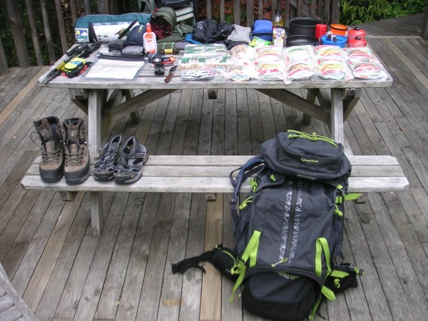
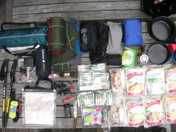
So what kind of items am I taking with me? Here is the full list (except for the food) with in most cases the brand/model of the item:
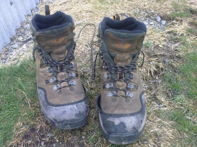
- Walking boots - Lowa Pro Tibet GTX
- Relaxation / wet footwear - Ahnu Reyes III
- Backpack - Quechua Symbium Access 70
- Walking poles - Leki Makalu Tour
- Personal Locator Beacon - ACR ResQFix
- 2-liter water bag
- 1-liter water bottle
- Transformable hiking pants - Columbia Silver Ridge
- Polyprop thermal leggings - MacPac Geothermals
- Polyprop thermal short and long-sleeves T-shirts - MacPac Geothermals
- Softshell thermal jacket
- Hardshell rain-jacket
- Over-trousers with full side-zips
- Cussioned hiking socks
- Knee-high gaiters - MacPac Cascade Gaiters
- Fleece beanie
- Thermal gloves - Odlo
- Sunglasses
- Lightweight tent
- Lightweight sleeping bag
- Sleeping bag liner
- Auto-inflating matress - Therm-a-rest
- First-aid kit
- Insect repelant
- Lightweight towel
- Swiss-army knife - Victorinox hunter's edition
- Topographical maps
- Headlamp - Black Diamond Spot
- Gas stove - MSR Pocketrocket
- Gas cartridge
- Lighter - Swedish FireSteel 2.0
- Pan
- Foldable cup and bowl
- Cutlery
Vescere bracis meis
Choosing what to eat when you walk for a week and have to carry everything with you is quite a science. Intensive walking days require of course more energy than usual and thus you have to get more energy (understand calories) out of your food. To make a long story short: I will be eating high-caloric food that also happens to be lightweight compared to the amount of calories that it contains. For a day of walking this is my menu:
- Breakfast
- 140 gram Muesli with oats & dried apricots
- 320 ml (equivalent) Powder milk
- Day snacks (no lunch)
- 200 gram 0at slices (various flavours)
- 180 gram Trail-mix (nuts, raisins, dried fruit)
- 1 liter (70 gram powder) RARO mix (energy drink)
- Dinner
- 100gr Pasta (various flavours
- 50 ml olive oil
- A few spoons of honey
I will carry 8 of such packs with me and 2 without the pasta for rest days.
Excursion photos!
I just published a new set of photos combining some dating back to my road-trip and new ones I made yesterday on a two-day excursion. See them here.
Snow, snow, snow
A little message in between two bigger updates. Snow has fallen on the moutains around Hanmer Springs and almost in town two days ago (18/10/2012). As my work today started in the late afternoon I went up the mountains to enjoy some white fun. The photos of this little expedition are now available.
The Next Step
Back on the Track
Time passes quickly and it is already mid-October when I'm writing this new update. The last two weeks have been extremely busy as it was a school-holiday period for New Zealand. This meant making long hours at work and not much time to do anything else. I however made some time for walking in the surroundings of Hanmer Springs. A few photos are available to show you what it looks like.
But more to the point: I have been in New Zealand since the first days of July. And the moment of my return to France is drawing near. This will be around mid-December and so only two more months remain for me to travel the country and that is why I will be leaving Hanmer Springs at the end of the month. My previous update about Scotties Hut (scroll down the page if you haven't read it yet) now seems a quite good introduction to what remains of my trip: tramping. As a matter of fact I am planning on continuing my travels on foot for the last weeks and to do so I have been doing a lot of planning over the last few weeks. The preparation can be split up in three steps: planning, equipment and training. Today's update deals with the first part.
Where To Go?
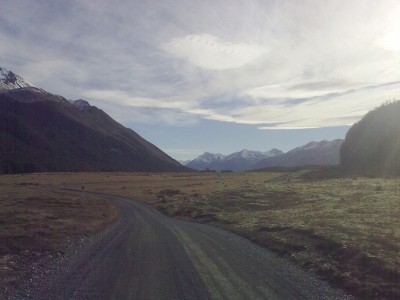
There are loads of trails that one can walk in New Zealand. From easy and relaxing one-hour strolls through forests and parks to exhausting multi-day routes in alpine landscapes and my personal taste goes more towards the latter. The first trip that I will be making will take me from Hanmer Springs to Arthur's Pass. Over the standard road this is a 271km drive but by taking a shortcut through the mountains this is reduced by half. Below follows a description of the track that I will follow:
- Hanmer Springs
- Jack's Pass
- Clarence Valley
- Fowler's Pass
- Ada Flat
- Boyle River
- Boyle Village
- Hope River
- Lake Sumner
- Harper's Pass
- Otira River
- Arthur's Pass
The detailed track description that I will carry with me comes in two parts (Part 1, Part 2). Again if you want to follow the trip you will find the site NZ TopoMaps very usefull.
Going further
sAfter this first trail I have planned a second one that takes place on the borders between Otago, West Coast and Fiordland. It is a little bit longer and certainly much heavier. My first goal after Arthur's Pass will be to reach Wanaka (where I have been before!) and to take a few days of rest. Then I will travel to Makarora north of Lake Wanaka. This will be the starting point for the next trail that will bring me to Glenorchy. The short version again is:
- Makarora
- Gillespie Pass
- Wilkin River
- Rabbit Pass
- East Branch of the Matukituki River
- West Branch of the Matukituki River
- Cascade Saddle
- Rees Saddle
- Rees River
- Glenorchy
The detailed track description is over here.
My next update will deal with all the equipment and food supply! See you soon!
Scotties Hut
Tramping aka the New Zealand way of hiking
Tramping: The New Zealand version of hiking and outdoor walking. The specific terminology is justified by locals by the particularities involved in hiking in New Zealand with respect to other locations.
It has always been one of the main reasons for me to come to New Zealand: seeing and hiking through the magnificent outdoors. So it was already over due time that I gathered my gear and boots and set out into the wild. I had two days off work on 5 & 6 September and the weather forecast had been reasonable to good over the last week for these days. The only choice left that had to be made was the destination. With the help of two topographical maps of the surroundings of Hanmer Springs I choose to set out North on day one. There was not really a possibility to do a two-day circuit so I followed (almost) the same way back on the second day. With this link you will be able to follow my description of the route (each blue square represents one square kilometer).
Jacks Pass & Clarence Valley
Starting from the centre of Hanmer Springs (where I took in some last items from the convenience store) I followed Jacks Pass Road out of town towards the West and turned up North on Clarence Valley Road after 800m. This is a hardened gravel-road that slowly follows the western slopes of Mount Isobel up to Jacks Pass: a steady climb of 500 meters and 6km long. On top of Jacks Pass one can see almost all of the Hanmer Bassin with the Amuri Range on the southern border. On the other side is a downward slope leading into Clarence Valley.
Clarence Valley is named after the Clarence River (or is it the other way round?) that flows throughout for many a mile before it throws itself into the Pacific Ocean North of Kaikoura. The valley is quite wide, having on average 300 meters of completely flat ground between the surrounding mountains. Once on the bottom of the valley I took West again towards St.James Homestead another 4km down the road. At this point there are two possible directions when you're in a 4-wheel drive vehicle and another one for those on foot or on a mountainbike. It is this last option on which I set course into Peters Valley (North-West).
Peters Valley
Peters Valley is a narrow corridor between the tops of Peters Hill on the North-East side and the mountains of the St.James Range on the South-West side. It is in fact a short-cut between St.James Homestead and Edwards Valley to the North-West. This is where I exchanged the gravel-road for a mountainbike trail that led into the valley. This was also the point where I started noticing the differences between hiking in Europe and doing the same thing in New Zealand: river and stream crossing. Whereas in Europe the major part of hiking trails have a bridge or something equivalent when there is a river or stream to cross in New Zealand this is not the case: the only thing you can do is walk straight through it. This has of course a most predictable consequence: wet feet!
The trail followed up one of the sides of the valley as the centre is filled with a stream and sometimes swamps. At certain moments it was barely visible and so I soon had the feeling of being away from all forms of civilization deep into the untracked backcountry. Somewhere in the middle of the valley I took a break for my lunch. Since I left St.James Homestead the wind had been gaining in strength and it had now become a strong breeze on the border of a storm blowing straight into my face. The sky was however still blue with no visible clouds but, as anyone a little bit familiar with meteorology would know, this would not stay that way for long.
Time again to pick-up my backpack and half an hour later I had passed Peters Pass and stood on the highest point of the trip at around 928 meters above sea-level.
Edwards Valley & Scotties Hut
On top of Peters Pass I picked up a rough 4-wheel drive trail, that is to say two gulleys that anything on wheels witth enough horse-powers and axles can follow. This trail led me over a steep decent down into Edwards Valley. This valley is home to (what a surprise!) Edwards River. The trail stays for about 6km on the true left of the river (South). It then goes down into the depression created over the ages by the river before fording it a couple of times: at this point the river is about 5 meters wide and 40cm deep. Then there was a last climb out of the river depression and two last kilometers before arriving at Scotties Hut: my home for the night.
I
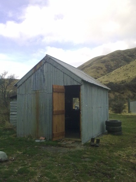 was happy to arrive as clouds had already started to take over the sky with the wind ever growing stronger. I took off my boots and changed into a dry pair of comfy loose shoes. Unluckily there was too much wind to even think of getting a fire going so I just relied on the wind to get the biggest part of the humidity out of my boots and socks. Scotties Hut itself is a basic but confortable place to shelter for the night with four bunk-beds, including thin matresses. As soon as I arrived I filled in the "intentions log" that keeps track of trampers on their journey. According to the log I had been the first person to stay at the hut since the start of winter in early June.
The river allowed me to replenish my water-bags and shortly after nightfall I got into my sleeping bag: I wanted to make an early start in the following morning.
Return via Edwards Flat
My alarm woke me up in the morning at first light. I quickly took some breakfast and gathered my gear. My boots and socks were still somewhat wet but that didn't matter: they were going to get wet again in a few moments. My boots hit the trail again at the time of (theoretical) sunrise. The sky was like a white ceiling of clouds with showers of rain every ten minutes. The wind, although not as strong as the day before, was going to keep me company again throughout the day. I retraced my (wet) steps eastwards through Edwards Valley upto Peters Pass again. From there on I choose to not dive into Peters Valley but to continue straight towards the East to join Tophouse Road at Edwards Flat. Tophouse Road led me then South towards St.James Homestead and the rest of my trip back to Hanmer Springs.
I took some photos at my arrival at Scotties Hut and on my way back.
Far, far away
On the road between Hanmer Springs and St.James Homestead I have been passed by two mountainbikers and two cars. On the road between St.James Homestead and Hanmer Springs I have been passed by two cars. Between the entrance to Peters Valley and my return to St.James Homestead I encountered no other human beings. The point being: you have a really strange I-am-in-the-middle-of-nowhere feeling. I was asked the question if I had felt lonely or isolated in the middle of this rough nature. My answer was: "On one hand you feel very small, really tiny small, but on the other hand there is a very strong feeling of strength and freedom: you are standing there at the centre of all this wilderness and you have the possibility to do whatever you want and to go wherever you like."
August
Long lost but not forgotten
Fewwww. It has been a long time since I wrote my last update on this page. Lots of things have happened in the meanwhile (or maybe not that many) and I have been quite busy settling into my 'new' life in Hanmer Springs. Anyway, the more frequent updates to which you were used are about to resume and I will try to catch up with the backlog of the news of the last month.
Robbie's
Of course a big part of the last month has gone up in my work as a waiter at Robbie's Bar & Bistro. I had to learn quite a few things about how everything worked and about the way they do things over here in such a venue. It's currently the winter season over here which means that the restaurant is not very busy during the week, the weekend however is quite another story as Hanmer Springs is the perfect place for two days off for many a cantabrian. The staff is made up of four people in the kitchen and four persons in the front and all are working on a saturday night. I will probably introduce you somewhat more to them in future updates.
As a waiter I usually work during the evenings, starting at 5:00 PM and finishing at closing time which is most of the time around 10:00 PM or later. There is in fact no fixed closing time and the actual time depends on how busy we are. Usual dinner time here is somewhere between 5:30 PM and 8:30 PM and this is also what I've seen in other parts of New Zealand until now. Once the last customers are out we still have to do the cleaning which can take up to one hour after a busy night.
Rain, rain, rain and... rain
During the last three weeks of August there have been few days without atleast some raindrops. This meant that most of the time I was inside occupying myself with books. During this time I resided at the same hostel as where I stayed during my first couple of days in Hanmer Springs: Le Gite Backpackers. Although this name sounds quite french the owner is in fact dutch. Again, because of the winter season, it was very quiet in the hostel and I had days where I was the only person in the house. I got to know the owner quite well and we've shared a couple of drinks since then at the hostel or in one of the local bars.
More stories in the next update. See you!
Monday, July 30th - Friday, August 10th
Tekapo & Wanaka
From Christchurch I set out towards the west. It was a rainy day and the landscapes that I crossed where all shaded in subtile shades of grey: misty and ghostly. This day took me to Lake Tekapo. Under more favorable conditions this lake is renowned for its particular blue color but, alas, the weather did not allow me to see it. I woke up the next morning with a soft coat of snow covering the car and all the surroundings. Still pursued by the snow and rain a drove on towards the town of Wanaka where I finally found some clemency in the weather. The town is located on the shores of the equally named lake and is home to a few of the most beautiful alpine sights of New Zealand. A nice atmosphere surrounded the cafes and bars in town with a busy winter crowd. This made me decide to stay there for an extra night to take advantage of the local climbing wall and walking tracks for some workouts. The camping ground at which I stayed was definetely the best I have encountered in all my trip: sauna & spa as well as a very nice kitchen and lounge. After this short R & R the highway took me onward towards Westland and the last part of my trip.
Westcoast
The drive from Wanaka towards my next stop in Fox Glacier took me through stunning landscapes. I have to say here that while I'm frequently referring to the nice views I get, the ones here were quite a level above all that I had encountered before. Starting out from lake and alpine views I went through pine forests down into tropical rainforests that then ended in white-sandy beaches before bringing me back to glacier country where the palm trees were still present. I stopped several times to take some photos.
In the small town of Fox Glacier I found out that the local camping ground was in fact more expensive to stay on then the backpacker hostel so I took a bed there for the following two nights. So what to do when you have whole day in front of you in a tiny town with a gigantic glacier nearby? Take a guided tour of the glacier? No... much too easy, think again. Go ice-climbing for a day on top of the glacier! This meant getting up early to gear-up at the glacier guides store before making our way on the ice using crampons and ice-axes. After a few exercices in the usage of the crampons we were ready to take on the serious business. We thought our day was finished when we did an almost vertical climb of 25 meters but no. The guides took us to one of the larger seracs close to the terminal face of the glacier. We were then lowered in to the serac down to the actual rockbed below the glacier after which we had to climb back up again. This involved an overhanging section which put us to the final test. The evening allowed me to get to know some other travellers in the hostel (Cheers if you are reading this! Thanks for the great discussions!).
When I arrived on Thursday in Fox Glacier at the hostel I knew that I would be leaving on Saturday towards Greymouth and I thus put out a message in the kitchen for any other travellers who wanted a lift. I had two responses and so I met Pauline and Yussef who are both travelling independently. It was a curious situation as we had six nationalities among us three, British / Irish (Pauline), Syrian / German (Yussef) and Dutch / French (me), and we spend a lot of time discussing the various experiences this had brought us over time. We decided to stay together for the night at the same place in Greymouth. Pauline was headed for Wellington, me for Christchurch and Yussef didn't have a specific plan. Sunday we all had different activities and mine involved travelling 30 kilometers to the north to Barrytown where I had the possibility to make my own true knife. A great thing to do as I was the only customer of the day and thus had a private session: a great thanks to Robin and Steve for this excellent moment and a nice souvenir! At the end of the afternoon we set out all three again towards the east through the Lewis Pass. A long deliberation the previous night had made us decide to continue together on the road towards Hanmer Springs.
Hanmer Springs
The town of Hanmer Springs is New Zealand's biggest thermal resort but on my first day I set out for some wine-tasting. This also allowed me to bring Pauline to her bus-stop from where she would get to Picton and Wellington. I discovered that, while New Zealand is certainly not (in my humble opinion) a country for good wine in general, they do produce atleast some good vintages here. The next day I delved myself deep into the hot pools and saunas of Hanmer Springs for some extra relaxation whereas Yussef left for Christchurch. Then on Wednesday came the time of my last day of my road-trip. It had been raining since the evening before and there were no other inside activities around town. Being in a good mood I thus took the chance to do some job searching at the local restaurants and cafes. It turned out that apart from being a rainy day it was also my lucky day as I landed an interview and a trial in the evening. A succesfull trial that was and I now have a job as a waiter at Robbie's. On Thursday I made a quick return trip to Christchurch (or Chch as the locals write it) to drop of and say goodbye to my beloved spaceship before starting my new 'career' as a waiter in Hanmer on Friday!
Thursday, July 19th - Sunday, July 29th
Life on the road
After a short flight to Queenstown (somewhat delayed due to mechanical problems on the airplane) and a breathtaking landing amidst the mountains it was time to pick-up my rental car and start travelling. As I have experienced over the last nine days the car itself is very cosy with plenty of space to sit be it for driving, eating or sleeping. Everything has been thought of and designed to take up as little space as possible.
Fjördland
My first stop, as is shown on the map in my previous post, was at the Mavora Lakes. The last 35 kilometers of the drive there are on an unsealed gravel road, my first experience of the New Zealand backcountry. Due to the delayed departure from Queenstown I got there well after dark which during this season in New Zealand falls at around 5:30 PM. So I just parked my car somewhere by the lakeside made some dinner and then started an early night. When I woke up the next morning all the windows were frozen... from the inside as during the night the temperature in the car had dropped to about 3 or 4°C. Guess I am lucky to have a double blanket!
After breakfast I got out for some walking around the lakes and took my first series of photos of the surrounding scenery. The Mavora North Lake has been picked as a location for some of the shots for the first and second of the Lord of the Rings movies and it was quite funny to recognize some of the scenes. But at the start of the afternoon it was already time to move on to my next destination: the Milford Sound road north of Te Anau. The drive there offered me some other spectacular views and I finished up camping at Deer Flat Camping Ground just before sunset. As during the previous night I had all the place to myself: in winter the number of campers is definetely close to zero. The surroundings didn't offer to much small walks so I packed up my gear pretty early in order to get back to Te Anau for a hot shower at the local camper facility (A nice system available in many towns). Continuing on my way south I passed by Manapouri and it's lake to reach the spot I had planned for camping that night. Guess what? No camping site anymore. I finished up finally at a small town which offered a good spot for the night.
The Catlins
The next step of the trip brought me down to the southern coast of New Zealand. I passed some nice ocean views, the city of Invercargill and the more rough part of the Catlins area while ending at Dunedin. A summary of photos can be found here but the whole trip took me three days.
 The first day took me passed the southern beaches, Invercargill and ended at Curio Bay. This particular bay is internationally renowned for it's colony of Yellow-eyed Pinguins, a nearly extinct species, as well as it's petrified Jurassic forest that is unique in itself. Just before sunset I got into my own encounter with the pinguins but the high tide did not allow me to get a real view of the 180 million year old trees. The next morning however the tide was low and I got to play all around the stone beach and forest as if it was my own private garden. Around the middle of the day I took advantage of the tide that was still low to take a two hour stroll around the neighbouring Porpoise Bay. But again it was time to hit the road!
After a short drive I got to Purakaunui Bay which is situated well more of the main road then Curio Bay. I was however not the only one around as it turned out. A canadian couple was about to leave when I arrived but they had run into a flat tyre. So I took them up with me to get it repaired at the nearest town: a nice occasion to meet some fellow travellers. They turned out to be also of the adventurous type as they are themselves hiking guides for the North Arctic region (Ellesmere Island). As the repairing didn't go as hoped for we spent the evening together as well as the next morning with a walk around the beach to see the seals and sealions we had already spotted the previous day from afar. After saying our goodbyes and exchanging our addresses I set out for Dunedin where I ended up on the Otago Peninsula at Portobello.
Central Otago & Canterbury
Taking some time to restore my batteries (those of my computer and telephone that is) I had hoped to enjoy Dunedin for the day but it appeared that there weren't as many activities as I had hoped for. Not waiting for anything to turn up by itself I decided I would just take up the northern road to get to know a little bit more about the Central Otago area. As these photos show it has been the right decision. By not staying on the main road but instead taking some unsealed country roads I was able to get some very pretty pictures.
 Another day further and I arrived at Methven, some 200 kilometers north of Dunedin and west of Christchurch. This town is actually a winter skiing place with the closeby Mt.Hutt and Mt.Sumers areas but I did not came for the snow. So on Friday (July 27) I took up a tour around one of the most spectacular filming locations ever (again from the Lord of the Rings): Mt.Sunday. This place is situated some 40 kilometers down an unsealed road and the views were just great and only the pictures can try to describe what it was like. That night I camped again at Methven. Saturday was not that much of a special day as it has most gone up in travelling but I ended up in Christchurch visiting someone who went to the same secondary school as I did back in Dieulefit, France. In order to get some sleep that night I drove somewhat out of town and parked on the side of a backcountry road.
As a famous cartoon would say "That's All Folks!", see you at my next report.
Thursday, July 12th - Wednesday, July 18th
A Week in Christchurch
As I promised at the end of my previous post I would be coming back with a new update once I had taken the time to get around Christchurch and the local activities. Again it has been a busy week, not always for the best I must say.
So, Christchurch. In case you did not now the fact, Christchurch has been the victim of multiple earthquakes since 2010. These quakes destroyed the major part of the CBD (Central Business District) including, sadly enough, the Christchurch Cathedral. Currently the demolition and repair works are going on at a steady pace but many years of reconstruction remain ahead. As a result Christchurch has become a quiet city, almost ghostly at some moments. I will not go into a further description but to give an impression of what the effects of an earthquake are I took some photos.
Coming to the activities of the week I first had to recover from my flu. This itself took up untill Friday. In the mean while I stayed at the hostel, bought some food for the week. I also started planning om my next move after Christchurch. As the job search has not been very successfull I have decided on taking a three week full-time holiday, further details will be given below. Once I had put the flu aside on Saturday I went for the "must-see" attraction that Christchurch has to offer, namely the Antarctic Centre. What? You don't even know it? Be ashamed!... Eh that said, I in fact never had heard of it either before coming to the city. The fact is that Christchurch Airport is the location of the joint USA-New Zealand task force responsable for the exploration and scientific research on and around the south-pole. Around 70% of all logistical support the south-pole as destination comes through here. I took the occasion to take my own ride in a Hagglund exploration vehicle and meet the local group of Little Blue Penguins.
On Sunday I went for a physical work-out to the Adrenalin Forest. On the menu were: tree climbing, ropes, tarzan jumps, flying foxes and other crazy stunts. After all the sports Monday was kind of a rest day during which I planned some more for the upcoming three-week trip and Tuesday was photo-day throughout Christchurch.
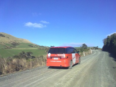
Road-trip
In order to fill up a three-week holiday I decided to rent a car/camper and to travel throughout the south island. I will be taking a vehicle from Spaceships, a concept of which I haven't seen the equivalent in Europe (eventhough it seems the same company operates in the UK too).
Agrandir le plan
To the right-side of this text you should be seeing a map of the trip that I will be making. It starts in Queenstown (not in Christchurch, don't ask me why...) and will take me to Christchurch 22 days later. In the case that there is a problem with your internet browser or with the way the webpage is displayed here is a link to the same map.
All along the way I will try to take as many pictures as are necessary to give you the same sights that I will be getting. Of course I will not be able to give updates as frequent as usual but at the end you will get all the pictures. ;-) I will also be making some visits to specific places of interests and enjoy some extra activities all along the way.
Wednesday, July 11th
The last three days have been quite active. On monday I've been crossing through Auckland in different directions. In the afternoon I decided that I wanted to go earlier to Chirstchurch then I had anticipated. So that meant booking the trip and accomadation accordingly. Last minute travel planning: must be one of my favourite activities. ;-)
As a result I stepped on an InterCity coach line at 9:15 on tuesday morning and arrived at 20:35 at the Wellington railway station. Transport in New Zealand, set aside airlines, are definetely working on a slower rythm than in Europe. However while taking the time to do the journey I had the chance of admiring some quite spectacular views. Most of all Mt. Tongariro which I passed by at a short distance. For those who do not now the fact: this mountain, of a very vulcanic type, has been used as Mt. Doom in the Lord of the Rings movies. Now however it was covered in snow with skiing ressorts not that far away on other mountains. I have certainly tried to take some pictures through the bus windows but this was not as successfull as I had hoped for. So no pictures, sorry guys! But rest assured: I will most certainly go back there later on for some more extensive local travelling.
After a short and not that resting night (I've got a flu since monday morning) at the Wellington YHA hostel I got on the InterIslander Ferry service running from Wellington down to Picton on the southern island. I am writing this post in a front seat on the ship with a great view on the south island mountain ranges (Yes! Pictures are here and this time with some comments). Once I arrive at Picton another coach line will get me to Christchurch by the evening just in time to make some dinner.
The next report will come up once I have made my way around Christchurch for a few days. Untill then, see ya!
Wednesday, July 4th - Sunday, July 8th
Time for a wrap-up of my first week in the other hemisphere. It has been full of impressions and new experiences, both positive and negative. I'll just try to be as complete as possible but as always with such things it is subject to the usual human subjectivity (pun intended).
Wednesday
The information session provided by the local agency of Work'n Holiday has been very thorough. It was of the kind that makes you want even more of the adventure and it took up all the morning. I was told everything about the land of kiwis and the things to do while being around. It also gave me some practical ideas about how to organize my visit. The afternoon was then filled with another session about finding a job and the particularities of this activity in New Zealand. One thing however that has bugged me from the start is the very strong presence of the german community. I've been the only frenchy around exception made for one of the members of the agency. During the evening after sunset I visited the harbour after the early nightfall (it's winter over here).
Thursday
On thursday my actual job search started. This meant first of all modifying my CV to the local standards and usages, subscribing to some specialized websites and looking out on some job advertising boards. I would like to work in the hospitality and event industry and so in the afternoon I went from hotel to hotel distributing my CV and filling in application forms wherever I could. Again the fact of hearing only german, be it at the hostel or at the agency, made me feel like I've landed in Berlin and not in Auckland. That is the only strong drawback untill now that is. In the evening I participate in an organized pub crawl to find out what the local nightlife is like. It finally allowed me to meet some people, mostly backpackers like me, from all over the world. Still no frenchies in the lot but still two dutch students.
Friday
Friday saw me making some more job applications on the internet. I focused on the region of Christchurch instead of Auckland as I would be glad to leave the city to see some more of the southern island and country New Zealand. Now don't get me wrong here: Auckland seems to me like a real great city. However it remains a big city and as such holds to the international image one can expect of it. I got to bed early as jetlag finally seemed to catch up with me.
Saturday
My first day of weekend in New Zealand! I must say I didn't go for the adventure directly as I hanged around in the city for the whole day. Time to discover what Auckland is like once you get out of the "CBD" (Central Business District). I pity I didn't took some pictures as you can clearly see how the city is build on an enormous volcanic field with "hills" all around that are in fact the tops of the volcanoes. During the evening I joinded with some people at the hostel that prepared an international meal with specialities from all over the world.
Guess what? At last a frenchy who was making some crêpes for dessert! I know it may sound funny but you feel at lot less lonely once you meet someone from the same country as you are, especially when everybody is telling you from the start that there are french people everywhere in Auckland. I also met a scottish guy and a dutch-american girl
 (well with a 100% dutch character I have to say, 0% american) with whom I talked throughout the evening and part of the night. A really pleasant experience as they both have already travelled a lot through this part of the world and in life in general.
Sunday
This morning I'm writing the current post from one of the benches in the harbor (36°50'24" South, 174°46'7" East). The sun is shining in full and the sky I as blue as in your best dreams. I finally decided on making some photos (Link to photos). See you soon for more kiwi news!
D-day
Less than 24 hours later I'm now here in Auckland and waiting for the information session. The last part of the trip was quite uneventfull. The famous New Zealand customs and bio-security were in fact not that bad at all and it only took a few minutes to get through. Once I arrived at the hostel (A very good one that is!) I got into the room that I'm sharing with two german guys. They are both at the end of their own holiday so it has been a short but pleasant encounter.
Flight Number 1 - From Paris to Kuala Lumpur
I just got of the first flight after landing at Kuala Lumpur Airport in Malaysia. It may be about one a'clock in the morning in France but it's about 7 in the morning here. Your mission, should you accept it, is to find some breakfast (picture ;-) )! Spy reports show that people around here like taking curry for breakfast here. Any additional information on the subject would be of great value to the agency.
Next stop Auckland and another 12 hour flight!
Ready for Take-Off - Thursday, June 28th
Still a few days to go and I my appartement is littered with clothes, bags and travel accessoires. I'll be getting on the train towards the airport next sunday. My flight is scheduled for 12:00 AM on monday. From Roissy - Charles de Gaulle airport I am flying with Malaysia Airlines towards Kuala Lumpur, a 11 hours and 30 minute flight that is. After a 2 1/2 hours stop there the second part of the trip will take me to Auckland International in approximatly 12 hours. So after a 26 hour trip I'll be glad to get into a shuttle for the hostel where a fine bed is waiting for me for the next three days.
I don't really know yet what to expect from the information sessions that I'll be attending during these first days. A lot of information about working in New Zealand, getting a bank account and tax-number I suppose. Finding a job will be my top priority I guess.
Whatever the reality will be it should in every case be an interesting experience. The next time that I'll write something on this blog it will be from the other side of the world, Auckland or maybe Kuala Lumpur.